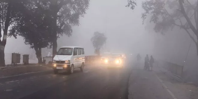
new Delhi. With the beginning of the new year, cold wave conditions have returned to large parts of northwest India and the Meteorological Department has forecast dense fog in Uttarakhand, Punjab, Haryana and Uttar Pradesh for the next three days. The Meteorological Department said that isolated parts of Uttarakhand, Punjab, Haryana, Chandigarh, Uttar Pradesh and West Madhya Pradesh are likely to experience cold conditions in the next two days.
Due to gentle winds and high humidity near the surface in the Indo-Gangetic plains, fog is common at this time of year because in cold winter conditions, moisture condenses to form liquid droplets in the air that form fog. takes. The India Meteorological Department said that due to northwesterly winds coming from the Himalayas in the plains of northwest India, the minimum temperature in northwest and adjoining central India is likely to drop by two to four degrees Celsius during the next two days. is likely to.
Under its influence, cold wave to severe cold wave conditions are likely to prevail in the northern parts of Rajasthan till Tuesday. There was some relief from the cold wave conditions in Delhi and surrounding areas last week.
Why is winter getting shorter
Winter has been relatively mild over most parts of North India except in the second half of December, while cold wave and dense fog conditions were observed over North and North West India. The Meteorological Department has attributed the low cold conditions over North India to the lack of strong Western Disturbances or extra-tropical weather systems, causing rain in the plains and snowfall in higher altitudes.
There were seven Western Disturbances this December, out of which six were weak over India and only one (from 28-30 December) was strong. The recent extra-tropical weather system caused season’s first snowfall and rain over the higher reaches of Jammu and Kashmir, Himachal Pradesh and Uttarakhand during the last three days.
Rain will be less than normal from January to March
The Meteorological Department has forecast 86 per cent less rainfall than the long period average (LPA) normal rainfall over northwest India between January and March. The LPA of rainfall over North-West India for January-February-March is about 184.3 mm.
IMD Director General Mrutyunjay Mohapatra said on Saturday, “If there is a sign of reduction in rainfall, it means that the activity of western disturbance is likely to reduce. When the Western Disturbances are less, then northwesterly winds can blow over parts of northwest India.
He said that the minimum and maximum temperatures may remain low in Madhya Pradesh, southern Uttar Pradesh, eastern Rajasthan and surrounding areas. “Temperature will be normal in Haryana and Punjab and may be above normal in higher reaches like Himachal Pradesh, Jammu and Kashmir,” Mohapatra said.
 Indian Thought Latest News & Views


